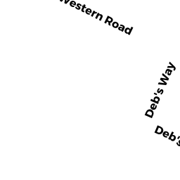
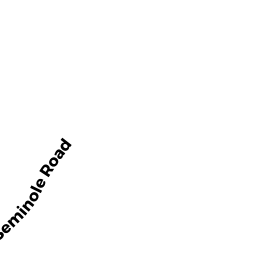
76 DEBS HILL RD UNIT 47B
Owner Information
TRIPP JUDITH E
76 DEBS HILL RD UNIT 47B
YARMOUTH PORT, MA 02675


Property Details
76 DEBS HILL RD UNIT 47B is classified as a CONDO NL MDL-0 (Condominium).
The primary structure on this property was built in 1983. There are 2,524ft2 of built area within this property. There is 1,170ft2 of residential/living space within this property.
76 DEBS HILL RD UNIT 47B is valued at $277,700. The land is valued at $0 and the structures are valued at $275,800. There is an additional valuation of $1,900 on this property.
The most recent deed for 76 DEBS HILL RD UNIT 47B is recorded at the local registrar in Book 28599, Page 207. 76 DEBS HILL RD UNIT 47B was last sold on Monday, December 29, 2014 for $206,000.
Assessment data from fiscal year 2022.
Flood Data
According to the FEMA National Flood Hazard Layer, this property does not appear to be in a flood zone. It may also be in an area not yet reviewed. Nonetheless, confirm this information prior to taking any action.
To view the flood hazards around this property, create a FEMA "Firmette" Map of the area around 76 DEBS HILL RD UNIT 47B.
Broadband Internet Providers
| Provider | Type | Bandwidth (mbps) | |
|---|---|---|---|
| Viasat Inc | Satellite | 35 | 3 |
| GCI Communication Corp. | Satellite | 0 | 0 |
| Comcast | Cable | 1000 | 35 |
| T-Mobile | Fixed Wireless | 25 | 3 |
| HughesNet | Satellite | 25 | 3 |
| VSAT Systems, LLC. | Satellite | 2 | 1 |
| Verizon New England Inc. | DSL | 5 | 0 |
Broadband service provider data from December 2020.
Adjacent Properties
- WEST GREAT WESTERN RD
SELECTMEN VAC owned by TOWN OF YARMOUTH - 84 DEBS HILL RD UNIT 48A
CONDO NL MDL-0 owned by VAN ESSENDELFT DENNIS A - 82 DEBS HILL RD UNIT 48B
CONDO NL MDL-0 owned by COLE SANDRA H (LIFE EST) - 72 DEBS HILL RD UNIT 46A
CONDO NL MDL-0 owned by HAMILTON DOROTHY J TR - 70 DEBS HILL RD UNIT 46B
CONDO NL MDL-0 owned by LALLY JOHN P (LIFE EST)